
Since 1980, the United States has sustained over 387 one-billion dollar weather and climate disasters. As the new movie "Twisters"—which features fictionalized extreme weather events— hits the big screen this July, the United States has already experienced 15 real-world billion-dollar weather events (as of July 9).
These events include tornado outbreaks, high wind, hailstorms, winter storms, flood events, tropical cyclones, wildfires, droughts, and heat waves. As the number and cost of weather and climate disasters increases over time, NOAA is exploring novel ways to gather data before and after these disasters to protect lives and livelihoods, including the use of uncrewed systems.
Check out these interesting projects that the Uncrewed Systems Operations Center has funded to develop NOAA capabilities in understanding extreme weather events.
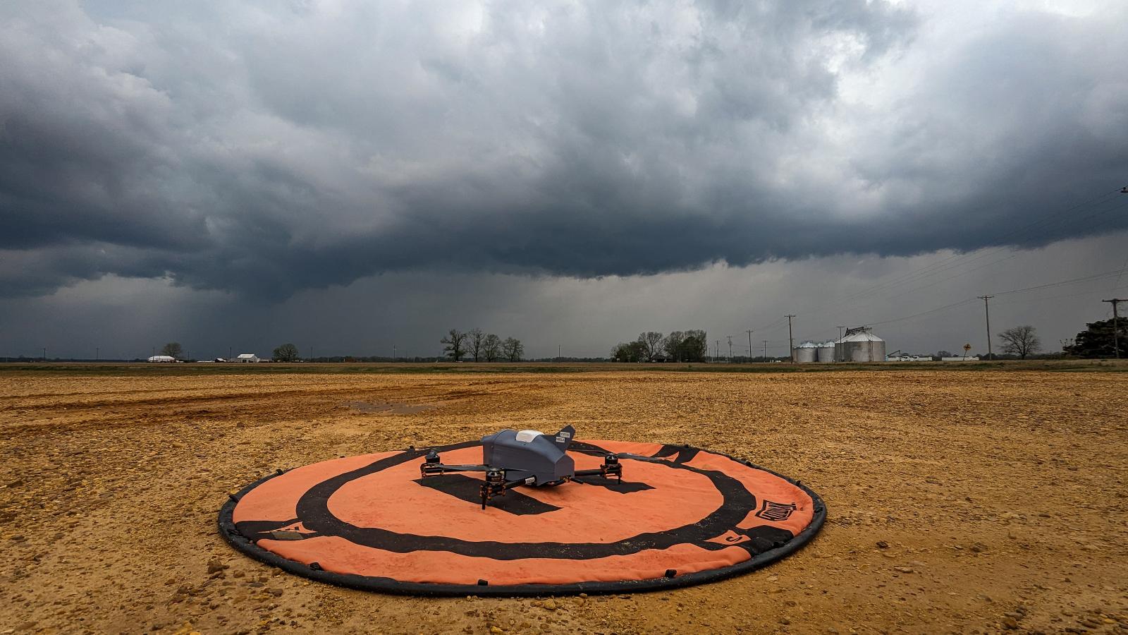
Advancing Sampling Abilities in Severe Environments
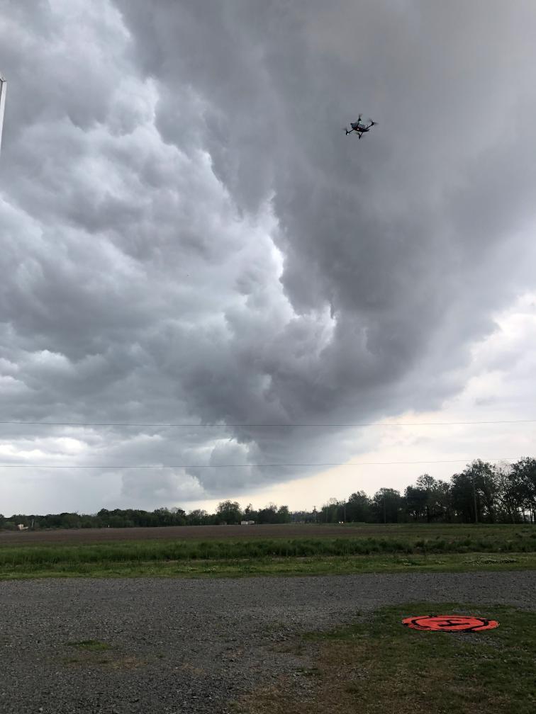
The NOAA National Severe Storm Laboratory is working with partners at the University of Oklahoma and Cooperative Institute for Severe and High-Impact Weather Research and Operations to fill observational gaps using uncrewed aircraft, which can support research to improve weather predictions and warnings.
The team is developing the next generation of the Coptersonde weather-sensing uncrewed aircraft to better meet NOAA mission needs. Starting from the current model designed by the University of Oklahoma, their project aims to advance the Coptersonde’s capabilities to withstand Category 1 hurricane force winds and to fly to 10,000 feet, while maintaining its reusability and accuracy.
In doing so, NOAA gets the high-quality data it needs from more turbulent, high-impact environments to improve weather forecasting in a more efficient and sustainable manner.
Investigating the Impact of Uncrewed Aircraft Observations on Weather Forecasts via Simulations
While actual atmospheric observations are necessary to gather the data needed to better understand extreme weather events, researchers at NOAA are also using simulation experiments to inform and optimize future networks of uncrewed aircraft for weather observations.
Researchers at the NOAA Global Systems Laboratory are using Observing System Simulation Experiments to determine what configuration of uncrewed aircraft operations would best support NOAA’s weather observation needs. The NOAA researchers and their partners at the University of Nebraska–Lincoln and University of Colorado Boulder utilize NOAA’s Research and Development High Performance Computing System to create and evaluate simulated scenarios across the entire United States. These simulated experiments can help determine things like the optimal number of platforms in the network, altitude they should fly at, how often they should be deployed, and more.
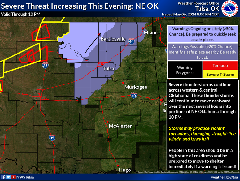
Improving Hazardous Weather Warning Lead Times
In order to accurately forecast small-scale and rapidly evolving weather events and provide enough warning lead time to the public during those events, the NOAA National Weather Service needs quality data from within the Atmospheric/Planetary Boundary Layer (the atmospheric layer closest to the Earth’s surface, sometimes extending up to 10,000 feet above it).
The Weather Forecast Office–Tulsa and its partners at Oklahoma State University, Virginia Tech, and Ronin Institute are working to improve hazardous weather warning lead times by exploring the use of uncrewed aircraft with weather sensors to gather data from the Atmospheric Boundary Layer. The use of uncrewed aircraft may enable repeatable, scalable and economical data gathering to inform weather forecasts.
Contributing to Hurricane Situational Awareness and Forecasting
Hurricanes pose an extreme threat to life and property and are one of the most powerful known forces of nature. In order to better understand hurricanes and improve hurricane forecasts with the goal of protecting lives, the NOAA Atlantic Oceanographic and Meteorological Laboratory, in collaboration with the NOAA Pacific Marine Environmental Laboratory and their industry partners, is working to develop new ways to safely gather data from within hurricanes. They are exploring the use of aircraft-deployed uncrewed aircraft to gather data throughout the hurricane from near the surface to 10,000 feet above, as well as Saildrone uncrewed surface vehicles that can be piloted into the paths of hurricanes. Both platforms gather data within the air-sea boundary layer, which is a critical area to sample for understanding hurricane intensification. These platforms provide information to the NOAA National Hurricane Center to improve situational awareness, with some also going into computer forecast models– all with the end goal of improving hurricane forecasts.
Performing Post-Storm Damage Assessments
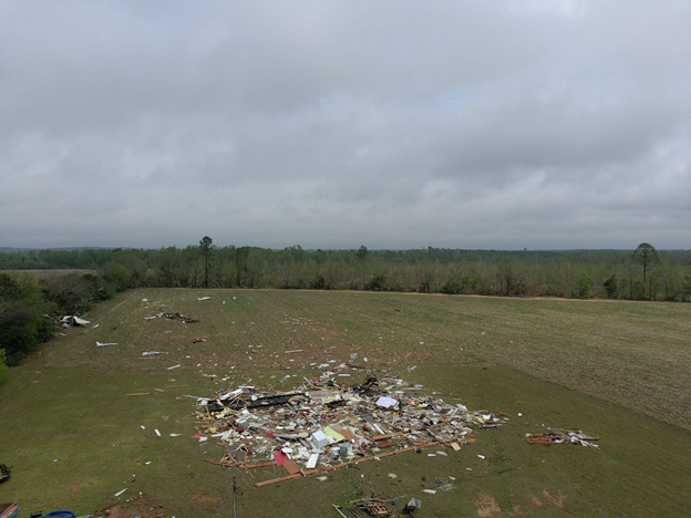
After severe weather events occur, NOAA personnel support the post-storm assessment and recovery process. In many regions of the U.S., NOAA uses uncrewed systems to improve the efficiency and safety of storm damage assessments.
For example, the NOAA Weather Forecast Office– Louisville team uses uncrewed aircraft to survey after tornadoes and flooding in their area of responsibility (see photo to right). Other Weather Forecast Offices are exploring the use of uncrewed aircraft to perform storm damage assessment, or are working with industry and academic partners to enhance post-storm damage assessments.